Hunter Geophysics offers a geophysical data processing service. All you need to do is to upload your data to our FTP server, provide us with the survey metadata (we can help you with this if needed), tell us what targets you’re looking for in your data, and then you can sit back while we do the processing for you.
Contact us to discuss pricing. Your first data processing project will receive a 30% discount!
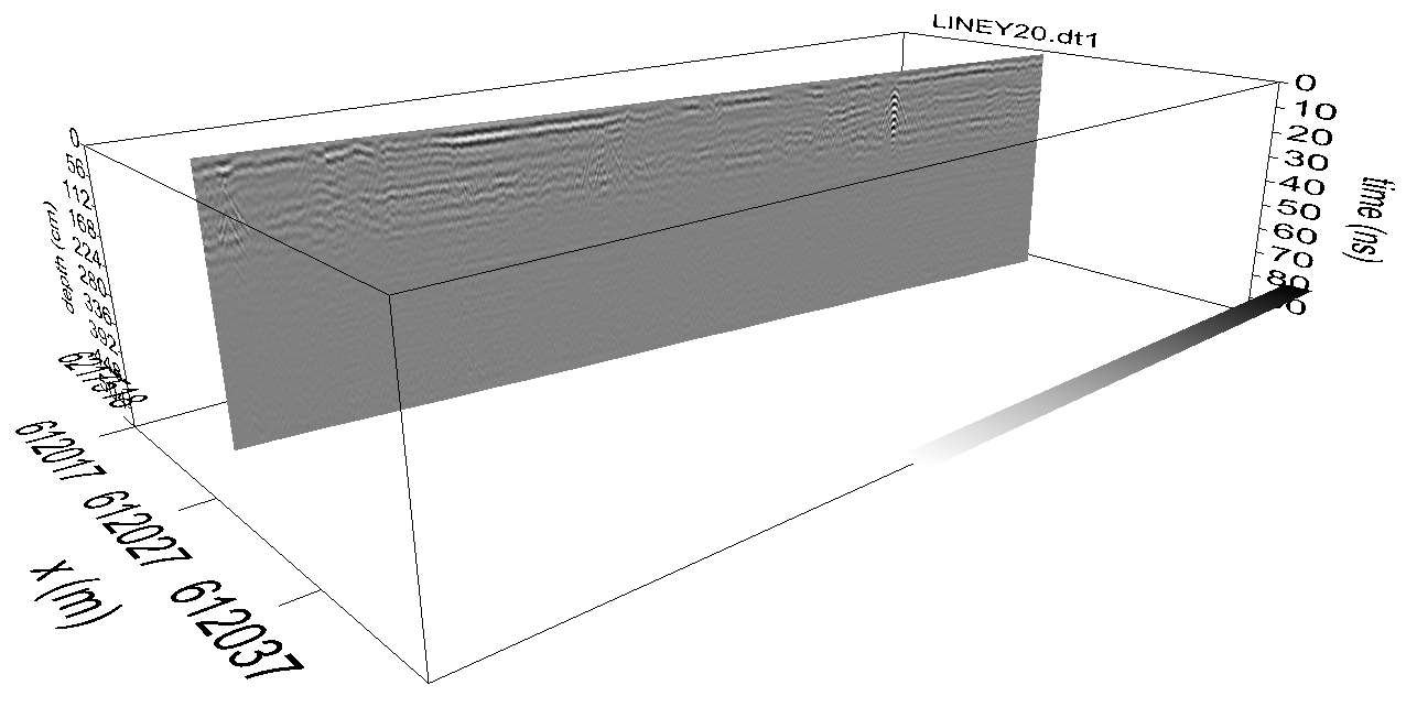
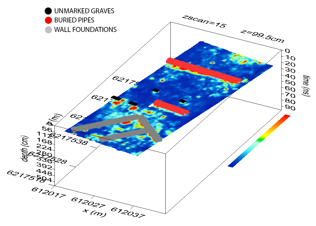
Please refer to the Hunter Geophysics data processing brochure for examples of processed datasets.
A skilled geophysicist is responsible for each step of the process to ensure you get the best-quality results from your data.
If requested, Hunter Geophysics will also interpret the results of your survey for you, and even write a consulting report on your behalf to give to your client. Interpretations can be provided in GIS and CAD formats, including SHP, KMZ, and DXF, among other formats.
Our service helps you save time and lets you get on with your next job, so you can earn more money. It makes sense to get us to do the data processing for you.
Supported data includes…
- GROUND PENETRATING RADAR (including Sensors and Software, Mala GPR, GSSI, US Radar, 3D Radar, Utsi Electronics GPR, and many other systems). Ground-penetrating radar data is processed using the popular and highly capable GPR-SLICE software, licences for which are also available for sale through Hunter Geophysics should you wish to process the data yourself.
- MAGNETOMETRY (both total field magnetics and magnetic gradiometry datasets are supported)
- ELECTRICAL RESISTIVITY (twin-probe only at this stage. If you need resistivity inversion or tomography data processed, please contact us).
- ELECTROMAGNETICS (both Time-domain/Transient electromagnetics and Frequency-domain electromagnetics, including in-phase and quadrature datasets)
- TOPOGRAPHY (LiDAR, laser scanner data, and other topographic data types are supported)
- TOTAL STATION/GPS MAPPING DATA. We use Global Mapper GIS which is compatible with just about anything. We also use AutoCAD.
…and more! Please contact us before committing to a survey to ensure we can support your equipment.